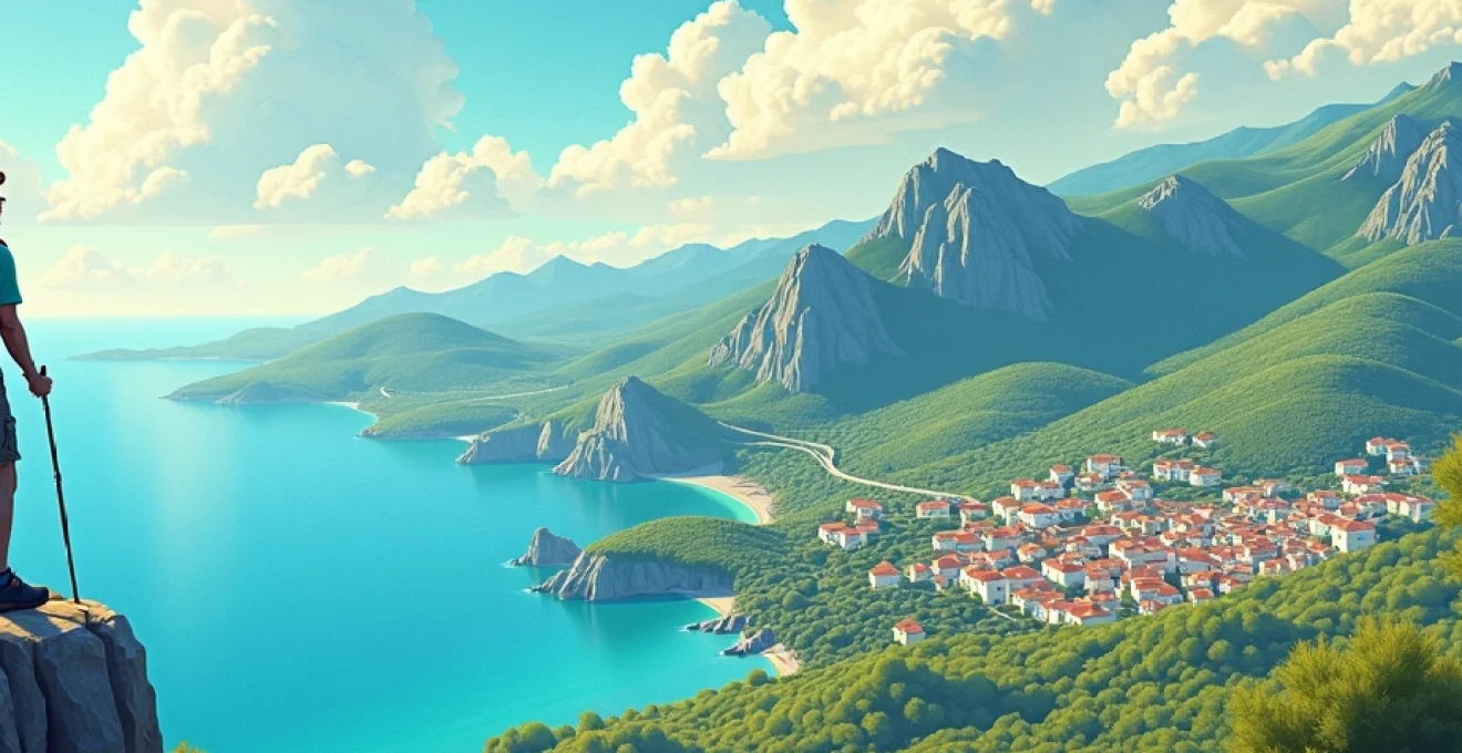
The Sartène region, in the heart of southern Corsica, offers a paradise for adventurous hikers. With its breathtaking landscapes ranging from rugged coastlines to imposing mountains, this area invites autonomous explorations rich in discoveries. However, venturing out without a guide requires careful and conscious preparation. Immersing yourself in Sartène’s unspoiled nature means confronting paths that cross Mediterranean scrub, oak forests, and centuries-old chestnut groves, offering spectacular views of the Mediterranean Sea.
Essential Preparations for a Safe Hike in Sartène
Before venturing onto the trails of Sartène, meticulous preparation is essential. Start with thorough research on the available routes, assessing their difficulty in relation to your experience and physical fitness. Obtain detailed maps of the area and, if possible, download reliable GPS applications on your smartphone as a backup.
Appropriate equipment is crucial for a safe hike. Invest in sturdy and comfortable hiking shoes, already “broken in” to avoid annoying blisters. Layered clothing will allow you to adapt to the sudden climatic changes typical of mountainous areas. Don’t forget to bring with you:
- Sufficient water (at least 2 liters per person for a day)
- Energy food and snacks
- First aid kit
- Sun protection and hat
- Lightweight raincoat
Route planning should include estimating travel times, taking into account stops and your abilities. Always inform someone of your plans, indicating the chosen itinerary and the estimated time of return. This precaution can prove vital in case of unforeseen events.
Check the weather forecast in the days before and the morning of the hike. Weather conditions in the mountains can change rapidly, so being prepared is essential to fully enjoy your adventure in Sartène.
Unmissable Itineraries to Explore the Sartène Region
Sartène offers a variety of routes that satisfy every level of experience, from light walks to challenging treks. Here are some itineraries that will allow you to explore the nature of Corsica in all its magnificence.
Scenic Trails along the Sartène Coast
The coastal path from Tizzano to Campomoro is a must for sea lovers. This route of about 12 km offers breathtaking views of the rugged coastline and the crystal-clear waters of the Mediterranean. Along the way, you will encounter hidden coves perfect for a refreshing break. The Senetosa lighthouse, the highlight of the route, offers an unforgettable panoramic view.
For a shorter but equally spectacular hike, the Red Rocks trail near Propriano is ideal. This 5 km route will take you through rock formations with reddish hues, creating a breathtaking contrast with the blue of the sea.
Routes through Picturesque Villages of the Corsican Hinterland
The itinerary that connects Sartène to Sainte-Lucie-de-Tallano will immerse you in the heart of the Corsican hinterland. This route of about 15 km crosses centuries-old olive groves and Mediterranean scrub, offering glimpses of the villages perched on the hills. Along the way, don’t miss the opportunity to make a stop in Fozzano, the village that inspired Prosper Mérimée’s famous novella “Colomba”.
Another fascinating itinerary is the path that connects Levie to Carbini, passing through the archaeological site of Cucuruzzu. This 10 km route will allow you to explore the millennia-old history of Corsica, from the Genoese towers to the prehistoric casteddi (fortresses).
Trekking in the Lush Forests of Inner Sartène
For more experienced hikers, the path that winds through the Ospedale forest offers an exciting challenge. This route of about 20 km will take you through larch pine and chestnut forests, with spectacular views of the surrounding mountains. Lake Ospedale, an artificial basin of surreal beauty, is the ideal spot for a regenerating break.
Another option for lovers of unspoiled nature is the path that leads to the Piscia di Ghjaddu waterfall. This 8 km route, although challenging in some sections, will reward you with the view of one of the highest waterfalls in Corsica, which plunges for over 70 meters into a spectacular gorge.
Practical Tips for Navigating Without Professional Guides
Navigating the Sartène trails independently requires skill and attention. The key to a safe and rewarding hike lies in knowing how to correctly read a topographic map and use a compass. Familiarize yourself with the symbols of the French IGN (Institut Géographique National) maps, which provide valuable details about the terrain and points of interest.
Using a GPS can be a valid support, but it should never completely replace the paper map and compass. Batteries can run out, and the signal can be intermittent in remote areas. Learn to recognize the cairns, small piles of stones used as trail markers, but be aware that in some cases they may have been moved or added by other hikers.
A fundamental advice is to always maintain awareness of your position. Stop regularly to compare the surrounding landscape with the map, identifying landmarks such as peaks, watercourses, or particular structures. If in doubt, do not hesitate to retrace your steps to the last known point.
Learn basic navigation techniques, such as triangulation with a compass, which will allow you to determine your position using visible landmarks. Also, familiarize yourself with the concept of azimuth, the angle between magnetic north and the direction of a specific point, useful for following a precise route.
Always keep a plan B in mind. Identify possible escape routes or alternative routes in case of bad weather or other unforeseen events. Flexibility and the ability to adapt to circumstances are essential qualities for every autonomous hiker.
Hidden Natural Wonders in the Sartène Region
The Sartène region hides natural treasures that often escape the most popular tourist itineraries. Exploring these places requires a spirit of adventure and respect for the environment, but the rewards are invaluable in terms of beauty and solitude.
The Gorges of Ortolo offer a breathtaking natural spectacle. This canyon carved into the granite over the millennia is accessible through a challenging path that requires attention and preparation. The natural pools that form along the course of the river are oases of freshness in the hot summer months.
Another hidden gem is Punta di Campomoro, reachable only on foot or by boat. This peninsula offers spectacular views of the coast and the open sea. The Genoese tower that dominates the point is a perfect example of defensive architecture from the 16th century and offers a 360-degree view of the Gulf of Valinco.
For geology enthusiasts, the Cauria site is a true open-air museum. This plateau hosts some of the most important megalithic sites in Corsica, including menhirs and dolmens dating back over 5000 years. The path that crosses this lunar landscape offers a unique perspective on the island’s prehistory.
Don’t forget to visit the Bosco degli Scolari, a forest of centuries-old oaks located near Sartène. This magical place, with its twisted and moss-covered trees, seems to have come out of a fairy tale. The circular path of about 3 km is suitable for everyone and offers an immersive experience in the most authentic nature of Corsica.
For birdwatching enthusiasts, the Baracci marshes represent a unique ecosystem in the region. This coastal wetland is an important stopover site for numerous species of migratory birds. A path equipped with information panels will guide you to discover the rich biodiversity of this delicate environment.
Safety in Autonomy: Precautions for Solo Hikers
Undertaking solo hikes in the Sartène region can be a deeply rewarding experience, but it requires an additional level of preparation and awareness. Safety should always be your number one priority.
First of all, it is essential to communicate your plans in detail to a trusted person. Provide precise information about your itinerary, expected times, and checkpoints along the way. Establish schedules for regular contacts and a clear protocol in case of missed communication.
Equip yourself with a reliable communication device. In addition to your cell phone, consider purchasing a PLB (Personal Locator Beacon) or a satellite device that works even in areas without cell coverage. These tools can literally save your life in an emergency.
Always carry an essential survival kit that includes:
- Thermal blanket
- Whistle for signaling
- Lighter or waterproof matches
- Multipurpose knife
- Emergency rations
Be aware of your physical and mental limitations. Solo hiking requires constant concentration and the ability to make quick decisions in stressful situations. Do not hesitate to modify your plans if the conditions are not optimal or if you feel uncomfortable.
Study basic first aid techniques and carry an adequate medical kit with you. Know how to treat the most common injuries such as sprains, cuts, or insect bites. Knowledge of how to manage situations of hypothermia or heatstroke can make the difference in critical situations.
Develop a proactive safety mindset. This means always being aware of your surroundings, anticipating potential hazards, and always having an emergency plan. Remember that there is no shame in turning back if the conditions become too risky.
Remember that solo hiking, although rewarding, involves inherent risks. Meticulous preparation and constant awareness are your best allies to safely enjoy the natural wonders of Sartène. With the right preparation, you can completely immerse yourself in the experience, letting the wild nature of Sartène envelop and inspire you.
Another fundamental aspect for the solo hiker is the management of energy and resources. Carefully plan your stops and rest periods, maintaining a constant pace that allows you to conserve your strength for the entire route. Regular hydration and nutrition are crucial: do not wait until you feel thirsty or hungry to drink or eat.